Sunday, January 16, 2011

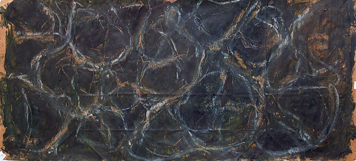
Ebenezer Drawings- "Black Water" Creating space

Sunken Ebenezer- Oil stick

I had some time to work on a collection of drawings last week. I started thinking about Ebenezer Creek again. I was looking at some photographs of a set up I did, and trying to figure out how to enhance the story telling elements. I want to create a emotion of the events there, an “atonement”, a non-literal representation. I thought about drawing over the photographs but I still haven’t found a convincing process yet. This time I am looking for a more abstract image. I started playing around with images of water. In particular the wave patterns on the surface. I have arranged the following drawings in the order that they were created

Oil Stick on paper
All these drawings are on paper grocery bags. One group of drawings is in oil sticks and oil paint on top of prepared paper. The second group is Conti crayon, sumi ink, white house paint, & tempera paint. In the first session the work evolved in two stages. First stage I worked with images of water waves viewed as if you were under the water or from the side, looking forward. The first drawing I also placed a rock like form in the center. The sunken Ebenezer.
Sumi Ink, Paint, Conti crayon on paper
Sumi Ink, Conti Croyon, Charcoal on paper
The next group of drawings I have changed the vantage point to above looking down upon the surface of the water. The waves form a pattern on top of a dark background. A sense of space is perceived by looking through the pattern. I tried to convey a sense of movement with the light colored wave pattern drawing. In a way, this work is similar to sumi ink drawings I created that related to my drawings of sound wave patterns. I progressed to the next session by starting with the elements that I liked from the first group.
Oil Stick on paper
Oil Stick on paper

Oil Stick on paper

With the next session of drawings I expanded on the idea of creating depth of field with adding an illusion of looking through the surface of the water. I applied cut out leaf patterns to the surface & worked on top of them. I also added a sense of perspective to the water pattern drawing. This added a landscape effect to the space.

Oil Stick on paper
Charcoal,paint, Conti crayon on paper

Charcoal,paint, Conti crayon on paper

Oil Stick on paper

Tuesday, January 4, 2011

Gettysburg November 23,2010


View Gettysburg Nov 23 2010 in a larger map

This is a map of my November 23 Gettysburg trip. For this trip I shot with the Holga 120N & the Holga Wide Pin-Hole camera. The weather was overcast & a little rainy. It seems like every time I go on these photo trips it's raining. The Holga 120N shots had that overlapped frame issue that I talked about in earlier posts, but I think I got some good shots. As I'm gaining more experience shooting with both of these cameras I am finding that I really like the result's I get with the Holga 120N. Although I like the wide view, long exposure, & unpredictable nature of the pinhole camera, I find that the quality of the image from the 120N is more what I'm after. The next trip I will shoot a little more seriously with it.
Holga 120N View of Culp's meadow from Cemetery Hill.

Devils Den Holga pin hole.

East Calvary Field. Site of Custer's Charge. Holga Pin-Hole.
Holga 120N- Rose Farm field. Site of the famous Gardner photographs of Confederate dead.            


Tuesday, December 28, 2010

Monocacy Battlefield-November 26, 2010 Pin Hole Photographs


View Monocacy Battlefield-November 26 2010 in a larger map
 Use the Google map to view the locations where the pin hole pictures were taken. 

View of Thomas Farm from the intersection of Araby Church Rd & Baker Valley Rd. Next to the Vermont marker.

View through the tree line on Araby Church rd.


View of Thomas Hill

I got to explore the Monocacy Battlefield outside of Frederick Maryland during the recent Thanksgiving holiday. I have been to this battlefield numerous times and it’s a fun place to explore, with a variety of landscapes. It is also close to where my mother is currently living in Gaithersburg Maryland. Growing up in Maryland I remember visiting the battlefield when I was a teenager. At that time there were only a couple of monuments & not much else. During school break my family would drive to Columbus Ohio to visit my grandmother. As we would pass by the battlefield my brother Richard or my Dad would always point out the marker visible from Interstate 270.

During this time it was also hard to find out much information about the battle. Little was accessible at the local library level. Maybe because the battle was minor in scale, and that it was seen at the time as a Southern victory, there was not much interest in it. Recently there has been a turnaround in thinking as historians are now realizing the importance of this battle. It is now referred to as the “Battle that saved Washington”.

To date the National Park Serves has done a tremendous job buying property, adding a fantastic new visitors center, building walking trails, and installing interpreter markers on the field.


 This is the first time I was photographing with black & white film. I used the Holga 120N & the Holga wide-angle pinhole camera. I made a quick trip around the field as I had to drive back to New York. The weather was cool with high clouds. This blog entry is my first attempt to explore the graphic potential of Google Maps by combining it with a photographic tour. It has been a creative goal of mine to integrate my photos with the landscape. I believe that this format is an interesting medium. It can create a different style of story telling.
Thomas Farm view from Baker Valley Rd.
Thomas's Barn with Brooks Hill to the Left.

Tuesday, December 21, 2010

The Battle of Pell's Point or Pelham October 18,1776

Glover's Rock. Pelham Park New York City. November 11, 2010 shot with a Holga 120N


During my research in documenting the battlefields of Brooklyn;  I became aware of the larger dramatic scope of events that took place in the greater New York City region in 1776. The battles of August 27 in Brooklyn were just the start of the English campaign to smash the rebel army of General Washington.  In doing this research I discovered battles that I never heard of before. One of these was the Battle of Pell’s Point.  I was looking through “New York 1776” the Osprey series by David Smith. Accompanying an illustration by Graham Turner I saw a short description of the Battle at Pelham. That in turn led to Wikipedia.
“The Battle of Pell's Point (October 18, 1776), also known as the Battle of Pelham, was a skirmish fought between British and American troops during the New York and New Jersey campaign of the American Revolutionary War. The conflict took place in what is now part of Pelham Bay Park in the Bronx, New York City.

View of Eastchester Bay. The English army landed on the left side of the image. Shot with a Holga 120N.
On October 12, British forces landed at Throgs Neck in order to execute a flanking maneuver that would trap Gen. George Washington, commander-in-chief of the American revolutionary forces, and the main body of the Continental Army on the island of Manhattan. The landing was thwarted by the Americans, and British commander Gen. Sir William Howe, commander-in-chief of British forces in North America, looked for another location along Long Island Sound to disembark his troops. On October 18, he landed 4,000 men at Pelham, 3 miles (4.8 km) north of Throgs Neck. Inland were 750 men of a brigade under the command of Col. John Glover. Glover positioned his troops behind a series of stonewalls, and attacked the British advance units. As the British overran each position, the American troops fell back and reorganized behind the next wall. After several such attacks, the British broke off and the Americans retreated.

The battle delayed British movements long enough for Washington to move the main army to White Plains, avoiding being surrounded on Manhattan. After losing to the British in a battle at White Plains, and losing Fort Washington, Washington retreated across New Jersey to Pennsylvania.”


Holga 120N shot of marsh land
After doing some more research I found a cool on line book by William Abbatt entitled “The battle of Pell’s Point (or Pelham) October 18, 1776” it’s a self-published book from 1901. This book has some great location photographs from 1900. It goes into great detail about the landscape of the area both at the time of the battle & time the book was published. I cross referenced this information with current maps & discovered that as opposes to most revolutionary war sites in New York this one has remained relatively undeveloped and is now part of Pelham Bay Park. The parks location also is close by my workplace!

Holga 120N with sun on marsh grass
These images are from my first visit. The timing of my first visit also fell on November 11th. I brought along some color film for my Holga pin-hole camera & B&W for the Holga 120N. I was hopping to catch the last of the fall leaves with the color film. The weather was cool but sunny with high clouds. I was already familiar with the roadways through the park but I need to reconcile them with sites from the battle. I knew that Glover’s Rock was marked so that was my first thing that photographed. Parking is limited in this area so a great deal of walking is necessary to get to the various locations. The battle it’s self took place over a distance of three miles or so as the British army tried to move inland. The action took place along various stone walls that are no longer there. Most the field is now part of a golf course! There are several trails that allow you to reach undeveloped areas in the park.

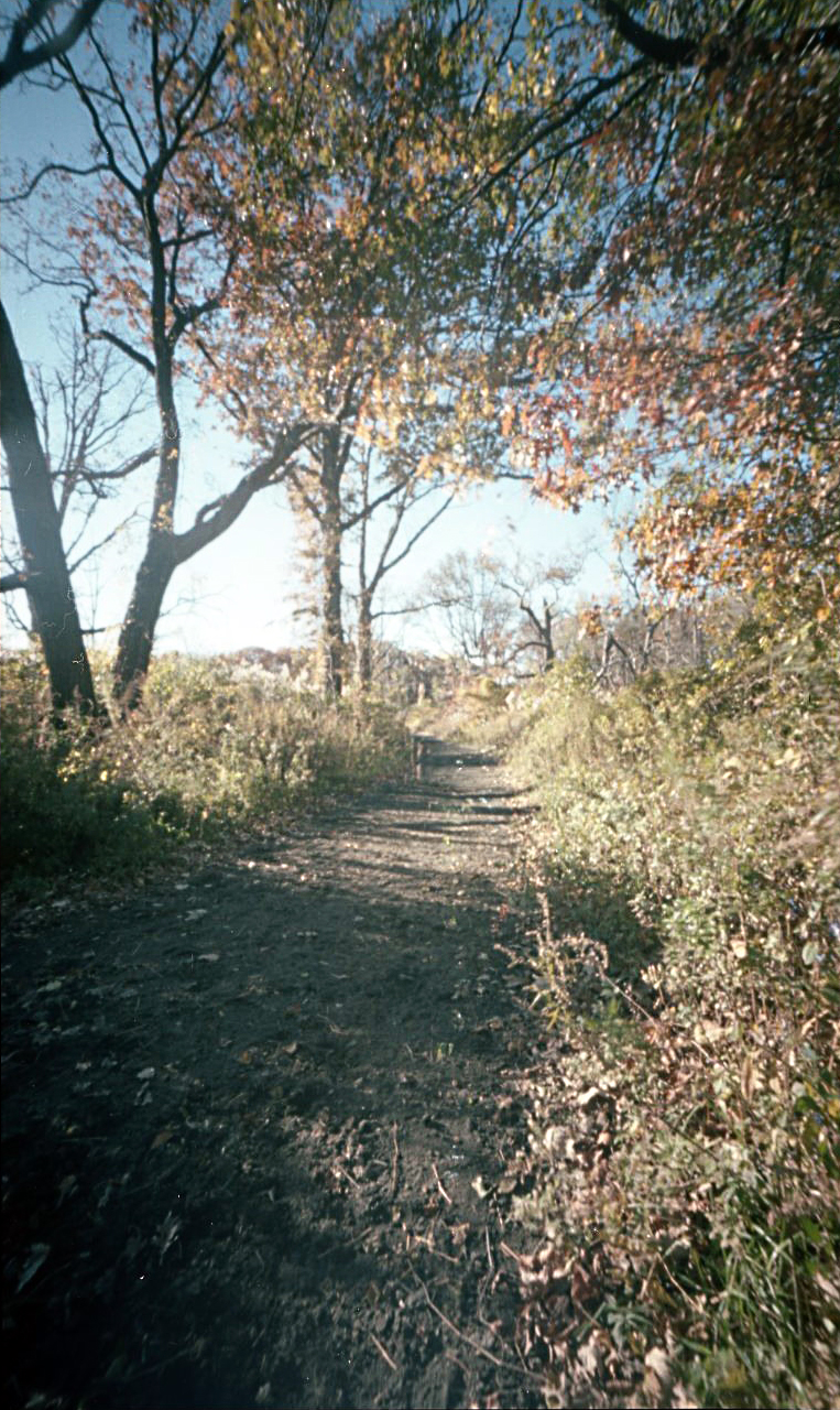
Color PinHole capture of the terrain around the Pelham Battlefield.
I messed up the Holga 120N roll by switching the view window to 16 & not switching the interior film mask to the smaller frame. This meant the all the photos overlapped on the sides. I was still able to salvage some cool shot’s though.

Eastchester Bay invasion route.


View Battle of Pelham in a larger map

Friday, December 17, 2010

Bedford Corners- Brooklyn

First color pin hole image. Corner of Halsy and Bedford.

“Bedford, in pre-American Revolutionary War times, was the first major settlement to the east of the then-Village of Brooklyn on the Brooklyn & Jamaica Turnpike to Jamaica, Queens and the rest of Long Island. It formed a major crossroads with roads to Williamsburg to the north and Bedford Road to Flatbush to the south.” 
Thanks Wikipedia. 
These images are from my on-going documentation of Brooklyn, New York City sites that were involved in the Battle of Brooklyn in 1776. This is the site of the town of Bedford. It figured prominently in Howe’s strategy of out flanking the American defenses. Not much remains from the revolutionary war times, except maybe the location of the roadways. I used my Holga wide angle pin hole camera. For the first time I shot some color Kodak Porta 160. Exposure time was about ten seconds. The shoot took place just after sun up on a quiet, but bright, Sunday morning in early November.


This image is of the intersection of Bedford and Fulton or the Jamaica Turnpike of yesteryear. To the center right of the frame (east on Fulton Street) is the direction that Howe’s English redcoats advanced from Jamaica Pass. According to Henry Whittemore in his 1897 book “The Heroes of the American Revolution- Battle of Long Island” “The whole force was about ten thousand strong!” Looking up the road today it's hard to imagine ten thousand men coming down that road.
Captain Francis Rawdon, Lord Hasting, was a member of the British flanking maneuver. 

“(We)…. marched with the greatest silence towards a pass some miles to the right of Flatbush, (Jamaica Pass) which being little known we thought would be but weakly guarded…. We got through the pass a daybreak without any opposition, and then turned to the left towards Bedford. When we were within a mile of that town, we heard firing… where General Grant was expected. We fired two pieces of cannon to let him know we were at hand”
Brevoort Place a nice sounding Dutch name. This is a cropped image. Unfortunately the negative was damaged during developing.
John Gallagher-by gaining the town of Bedford unopposed "The British plan had worked. Diverisons by Grant and de Heister had drawn the bulk of the American front-line forces to the west, leaving the way clear for an envelopment"
"The Battle of Brooklyn 1776"

Friday, November 19, 2010

Fort Defiance Red Hook Brooklyn

View of park entrance
“situated in such a manner as to command the harbor entirely"
 
Fort Defiance Red Hook or Louis Valentino, Jr. Park and Pier.
I had a chance to get some pinhole photographs of the Louis Valentino, Jr. Park and Pier. For this shoot I experimented with using a polarizing filter & a red no#25 filter with my Holga WPC 120. The filters don’t quite fit so I had to tape them in place. Some shots have a curved frame that resulted from the filter sticking into the area of view. The exposure worked out OK. I just held it open for a 15 count or so. It was late in the day facing into the setting sun visible through heavy clouds.
With this roll I also left out the interior-masking frame in the camera. I wanted to see what the fall off was like around the edges. However I found that I need to off set the winding of the film to compensate of the longer frame. Currently with the interior-masking frame in place, I advance the film to the odd frame numbers for each shot. Skipping over the even ones. Creating a negative that is two frames wide. With the masking out I would need to crank the film a little past the odd number so the image bleeds side ways farther. Other wise the pictures over lap side to side.
I had a hard time rolling this roll on the reel for developing. I tried over and over. I was so worried that the film was touching & would not properly develope. As it ended up some of the frames are creased and the last fame is scratched and torn.

During the Battle of Brooklyn in 1776, Fort Defiance was located about two blocks to the east from the current park, around the modern intersection of Coffey & Conover Streets. As with much of the low areas of Red Hook & the Gowanus the marsh land has been filled in. Changing the shape of the cost line.
From a contemporary account in the Gallagher book "The Battle of Brooklyn 1776" a Major Shaw noted-
“situated in such a manner as to command the harbor entirely. We have a fort with four 18-pounders, to fire en barbette. That is over the top of the works, which is vastly better than firing through embrasures, as we can now bring all our guns to bear on the same object at once. The fort is named Defiance.”
During the morning action on the 27th of August 1776. The redoubt opened fire on the HMS Roebuck. The Roebuck was trying to trying to force it’s way past the fort and returned fire. From the “Heroes of the American Revolution” by Henry Whittemore Page 20 states that "it’s unknown if any damage was inflicted on the Roebuck but she participated in the invasion bombardment of Manhattan at Kips Bay days later". The fort however was damaged in battle. Colonels Mifflin and Grayson visited the fort the next day found it “greatly damaged.


With red & polarising filter
without filter
Today the pier looks out over the upper harbor towards the Statue of Liberty. The small object on the horizon in the center of the frame.


"The modern park was named in honor of firefighter and Parks lifeguard Louis J. Valentino, Jr. (1958 – 1996). Over the years, Valentino lived and studied in a number of Brooklyn neighborhoods, including Sacred Heart St. Stephens in Red Hook, Xaverian High School in Bay Ridge, and St. Francis College in Brooklyn Heights. He then fulfilled his lifelong aspiration to become a firefighter, joining the New York City Fire Department in 1984. Valentino first served with Engine Company 281, where he battled fires for two years. He then moved on to Ladder Company 147, where he served until 1993, when he was accepted to the elite Rescue Company 2 in Crown Heights—joining the ranks of the city’s most experienced and versatile firefighters. Valentino was twice cited for his bravery, in 1987 and 1990.

On February 5, 1996, Valentino lost his life while searching for wounded firefighters in a three-alarm blaze in an illegal Flatlands garage. Louis Valentino, Jr. Park and Pier preserves the memory of a man who demonstrated selfless devotion to fighting fires and saving lives."

Above from the New York Parks web site-
http://www.nycgovparks.org/parks/B418/highlights/13125

Thursday, November 4, 2010

Pin Hole photographs of Fredricksburg battlefield

View looking down the wall at Mary's Hights
 Here are some pin hole photographs that I took over the past summer.
View of the old wall


The Innis House

View looking up Mercer St. toward the wall at Mary's Hight's. This is the approximate location of a small ditch that attacking Union troops sheltered in. The slight dip in the roadway is more apparent when you look down from the former Confedrate lines. This perspective gives you some idea of the distances involved.