Tuesday, December 28, 2010

Monocacy Battlefield-November 26, 2010 Pin Hole Photographs


View Monocacy Battlefield-November 26 2010 in a larger map
 Use the Google map to view the locations where the pin hole pictures were taken. 

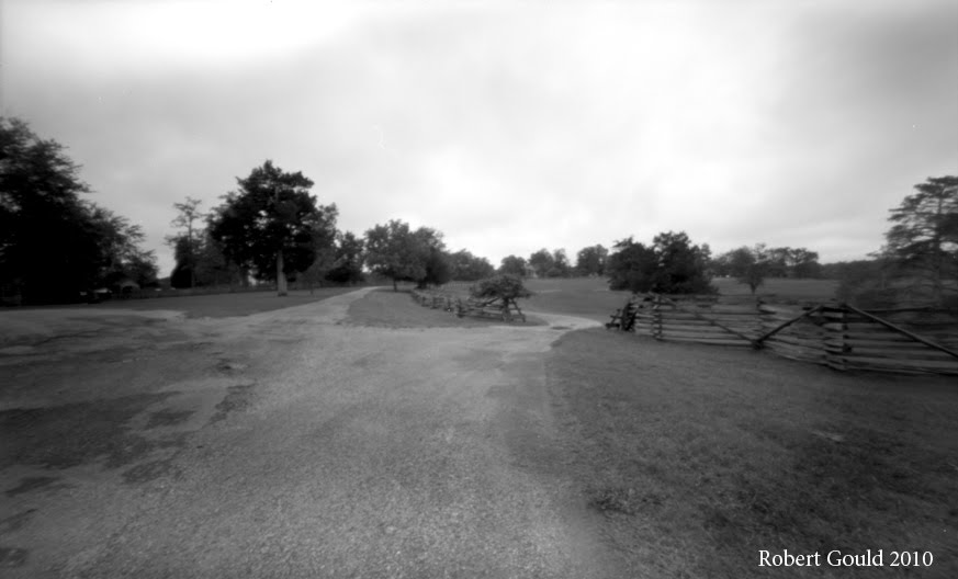
View of Thomas Farm from the intersection of Araby Church Rd & Baker Valley Rd. Next to the Vermont marker.

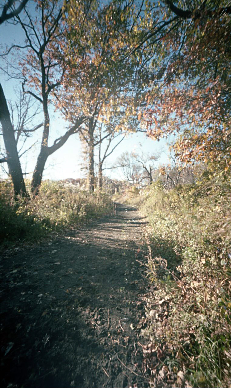
View through the tree line on Araby Church rd.
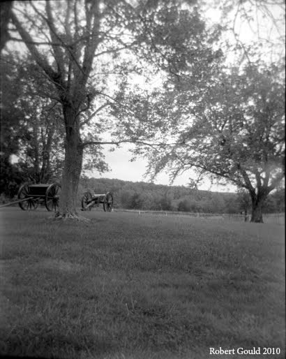


View of Thomas Hill

I got to explore the Monocacy Battlefield outside of Frederick Maryland during the recent Thanksgiving holiday. I have been to this battlefield numerous times and it’s a fun place to explore, with a variety of landscapes. It is also close to where my mother is currently living in Gaithersburg Maryland. Growing up in Maryland I remember visiting the battlefield when I was a teenager. At that time there were only a couple of monuments & not much else. During school break my family would drive to Columbus Ohio to visit my grandmother. As we would pass by the battlefield my brother Richard or my Dad would always point out the marker visible from Interstate 270.

During this time it was also hard to find out much information about the battle. Little was accessible at the local library level. Maybe because the battle was minor in scale, and that it was seen at the time as a Southern victory, there was not much interest in it. Recently there has been a turnaround in thinking as historians are now realizing the importance of this battle. It is now referred to as the “Battle that saved Washington”.

To date the National Park Serves has done a tremendous job buying property, adding a fantastic new visitors center, building walking trails, and installing interpreter markers on the field.


 This is the first time I was photographing with black & white film. I used the Holga 120N & the Holga wide-angle pinhole camera. I made a quick trip around the field as I had to drive back to New York. The weather was cool with high clouds. This blog entry is my first attempt to explore the graphic potential of Google Maps by combining it with a photographic tour. It has been a creative goal of mine to integrate my photos with the landscape. I believe that this format is an interesting medium. It can create a different style of story telling.
Thomas Farm view from Baker Valley Rd.
Thomas's Barn with Brooks Hill to the Left.

Tuesday, December 21, 2010

The Battle of Pell's Point or Pelham October 18,1776

Glover's Rock. Pelham Park New York City. November 11, 2010 shot with a Holga 120N


During my research in documenting the battlefields of Brooklyn;  I became aware of the larger dramatic scope of events that took place in the greater New York City region in 1776. The battles of August 27 in Brooklyn were just the start of the English campaign to smash the rebel army of General Washington.  In doing this research I discovered battles that I never heard of before. One of these was the Battle of Pell’s Point.  I was looking through “New York 1776” the Osprey series by David Smith. Accompanying an illustration by Graham Turner I saw a short description of the Battle at Pelham. That in turn led to Wikipedia.
“The Battle of Pell's Point (October 18, 1776), also known as the Battle of Pelham, was a skirmish fought between British and American troops during the New York and New Jersey campaign of the American Revolutionary War. The conflict took place in what is now part of Pelham Bay Park in the Bronx, New York City.

View of Eastchester Bay. The English army landed on the left side of the image. Shot with a Holga 120N.
On October 12, British forces landed at Throgs Neck in order to execute a flanking maneuver that would trap Gen. George Washington, commander-in-chief of the American revolutionary forces, and the main body of the Continental Army on the island of Manhattan. The landing was thwarted by the Americans, and British commander Gen. Sir William Howe, commander-in-chief of British forces in North America, looked for another location along Long Island Sound to disembark his troops. On October 18, he landed 4,000 men at Pelham, 3 miles (4.8 km) north of Throgs Neck. Inland were 750 men of a brigade under the command of Col. John Glover. Glover positioned his troops behind a series of stonewalls, and attacked the British advance units. As the British overran each position, the American troops fell back and reorganized behind the next wall. After several such attacks, the British broke off and the Americans retreated.

The battle delayed British movements long enough for Washington to move the main army to White Plains, avoiding being surrounded on Manhattan. After losing to the British in a battle at White Plains, and losing Fort Washington, Washington retreated across New Jersey to Pennsylvania.”


Holga 120N shot of marsh land
After doing some more research I found a cool on line book by William Abbatt entitled “The battle of Pell’s Point (or Pelham) October 18, 1776” it’s a self-published book from 1901. This book has some great location photographs from 1900. It goes into great detail about the landscape of the area both at the time of the battle & time the book was published. I cross referenced this information with current maps & discovered that as opposes to most revolutionary war sites in New York this one has remained relatively undeveloped and is now part of Pelham Bay Park. The parks location also is close by my workplace!

Holga 120N with sun on marsh grass
These images are from my first visit. The timing of my first visit also fell on November 11th. I brought along some color film for my Holga pin-hole camera & B&W for the Holga 120N. I was hopping to catch the last of the fall leaves with the color film. The weather was cool but sunny with high clouds. I was already familiar with the roadways through the park but I need to reconcile them with sites from the battle. I knew that Glover’s Rock was marked so that was my first thing that photographed. Parking is limited in this area so a great deal of walking is necessary to get to the various locations. The battle it’s self took place over a distance of three miles or so as the British army tried to move inland. The action took place along various stone walls that are no longer there. Most the field is now part of a golf course! There are several trails that allow you to reach undeveloped areas in the park.

Color PinHole capture of the terrain around the Pelham Battlefield.
I messed up the Holga 120N roll by switching the view window to 16 & not switching the interior film mask to the smaller frame. This meant the all the photos overlapped on the sides. I was still able to salvage some cool shot’s though.

Eastchester Bay invasion route.


View Battle of Pelham in a larger map

Friday, December 17, 2010

Bedford Corners- Brooklyn

First color pin hole image. Corner of Halsy and Bedford.

“Bedford, in pre-American Revolutionary War times, was the first major settlement to the east of the then-Village of Brooklyn on the Brooklyn & Jamaica Turnpike to Jamaica, Queens and the rest of Long Island. It formed a major crossroads with roads to Williamsburg to the north and Bedford Road to Flatbush to the south.” 
Thanks Wikipedia. 
These images are from my on-going documentation of Brooklyn, New York City sites that were involved in the Battle of Brooklyn in 1776. This is the site of the town of Bedford. It figured prominently in Howe’s strategy of out flanking the American defenses. Not much remains from the revolutionary war times, except maybe the location of the roadways. I used my Holga wide angle pin hole camera. For the first time I shot some color Kodak Porta 160. Exposure time was about ten seconds. The shoot took place just after sun up on a quiet, but bright, Sunday morning in early November.


This image is of the intersection of Bedford and Fulton or the Jamaica Turnpike of yesteryear. To the center right of the frame (east on Fulton Street) is the direction that Howe’s English redcoats advanced from Jamaica Pass. According to Henry Whittemore in his 1897 book “The Heroes of the American Revolution- Battle of Long Island” “The whole force was about ten thousand strong!” Looking up the road today it's hard to imagine ten thousand men coming down that road.
Captain Francis Rawdon, Lord Hasting, was a member of the British flanking maneuver. 

“(We)…. marched with the greatest silence towards a pass some miles to the right of Flatbush, (Jamaica Pass) which being little known we thought would be but weakly guarded…. We got through the pass a daybreak without any opposition, and then turned to the left towards Bedford. When we were within a mile of that town, we heard firing… where General Grant was expected. We fired two pieces of cannon to let him know we were at hand”
Brevoort Place a nice sounding Dutch name. This is a cropped image. Unfortunately the negative was damaged during developing.
John Gallagher-by gaining the town of Bedford unopposed "The British plan had worked. Diverisons by Grant and de Heister had drawn the bulk of the American front-line forces to the west, leaving the way clear for an envelopment"
"The Battle of Brooklyn 1776"

Friday, November 19, 2010

Fort Defiance Red Hook Brooklyn

View of park entrance
“situated in such a manner as to command the harbor entirely"
 
Fort Defiance Red Hook or Louis Valentino, Jr. Park and Pier.
I had a chance to get some pinhole photographs of the Louis Valentino, Jr. Park and Pier. For this shoot I experimented with using a polarizing filter & a red no#25 filter with my Holga WPC 120. The filters don’t quite fit so I had to tape them in place. Some shots have a curved frame that resulted from the filter sticking into the area of view. The exposure worked out OK. I just held it open for a 15 count or so. It was late in the day facing into the setting sun visible through heavy clouds.
With this roll I also left out the interior-masking frame in the camera. I wanted to see what the fall off was like around the edges. However I found that I need to off set the winding of the film to compensate of the longer frame. Currently with the interior-masking frame in place, I advance the film to the odd frame numbers for each shot. Skipping over the even ones. Creating a negative that is two frames wide. With the masking out I would need to crank the film a little past the odd number so the image bleeds side ways farther. Other wise the pictures over lap side to side.
I had a hard time rolling this roll on the reel for developing. I tried over and over. I was so worried that the film was touching & would not properly develope. As it ended up some of the frames are creased and the last fame is scratched and torn.

During the Battle of Brooklyn in 1776, Fort Defiance was located about two blocks to the east from the current park, around the modern intersection of Coffey & Conover Streets. As with much of the low areas of Red Hook & the Gowanus the marsh land has been filled in. Changing the shape of the cost line.
From a contemporary account in the Gallagher book "The Battle of Brooklyn 1776" a Major Shaw noted-
“situated in such a manner as to command the harbor entirely. We have a fort with four 18-pounders, to fire en barbette. That is over the top of the works, which is vastly better than firing through embrasures, as we can now bring all our guns to bear on the same object at once. The fort is named Defiance.”
During the morning action on the 27th of August 1776. The redoubt opened fire on the HMS Roebuck. The Roebuck was trying to trying to force it’s way past the fort and returned fire. From the “Heroes of the American Revolution” by Henry Whittemore Page 20 states that "it’s unknown if any damage was inflicted on the Roebuck but she participated in the invasion bombardment of Manhattan at Kips Bay days later". The fort however was damaged in battle. Colonels Mifflin and Grayson visited the fort the next day found it “greatly damaged.


With red & polarising filter
without filter
Today the pier looks out over the upper harbor towards the Statue of Liberty. The small object on the horizon in the center of the frame.


"The modern park was named in honor of firefighter and Parks lifeguard Louis J. Valentino, Jr. (1958 – 1996). Over the years, Valentino lived and studied in a number of Brooklyn neighborhoods, including Sacred Heart St. Stephens in Red Hook, Xaverian High School in Bay Ridge, and St. Francis College in Brooklyn Heights. He then fulfilled his lifelong aspiration to become a firefighter, joining the New York City Fire Department in 1984. Valentino first served with Engine Company 281, where he battled fires for two years. He then moved on to Ladder Company 147, where he served until 1993, when he was accepted to the elite Rescue Company 2 in Crown Heights—joining the ranks of the city’s most experienced and versatile firefighters. Valentino was twice cited for his bravery, in 1987 and 1990.

On February 5, 1996, Valentino lost his life while searching for wounded firefighters in a three-alarm blaze in an illegal Flatlands garage. Louis Valentino, Jr. Park and Pier preserves the memory of a man who demonstrated selfless devotion to fighting fires and saving lives."

Above from the New York Parks web site-
http://www.nycgovparks.org/parks/B418/highlights/13125

Thursday, November 4, 2010

Pin Hole photographs of Fredricksburg battlefield

View looking down the wall at Mary's Hights
 Here are some pin hole photographs that I took over the past summer.
View of the old wall


The Innis House

View looking up Mercer St. toward the wall at Mary's Hight's. This is the approximate location of a small ditch that attacking Union troops sheltered in. The slight dip in the roadway is more apparent when you look down from the former Confedrate lines. This perspective gives you some idea of the distances involved.

Saturday, October 9, 2010

Now and Then Trostle Barn Gettysburg

I put together a "Now and Then" photomontage of the Trostle Barn. It's kind of fun to walk the battlefields with a William Frassanito's book in your hand.

I am thinking that I should expand this blog entry because it is the subject of numerous “internet” searches. The photo above was part of a Gettysburg trip I took with my family in March 2009. It was the first time that I photographed battlefields using Holga 120 film cameras. I have never really used this type of camera before. It was on loan to me from Valerie my wife. She is a professional photographer and had used this camera for creating photomontages. Her web page is here-

One problem with this camera is that sometimes the film does not get wound tightly onto the film spool. When this happens light can get around the paper film backing and fog the film. That is what happened to some of these rolls. Now often I use a film changing bag when I change rolls of film. After shooting I had the film developed in a film lab. I was skeptical as to what my results would be. However after seeing the negatives, I was sold on the Holga format. In fact I bought some antique cameras hopping to get the same kind of unpredictable results, but so far the Holga remains my camera of choice.
Worm Fence above the Trostle Farm near the Peach Orchard.
My photo session started with no particular shots in mind. I remember just driving around thinking that would make a good shot. I soon found myself at the Trostle Farm. I also happened to have brought along William Frassanito’s book “Gettysburg A journey in Time”. And at this point I fished through the book and found the iconic O’Sullivan shot. The one showing Bigelow’s artillery horses lying in a pile. Walking out in to the field with book in hand I lined up the camera angle.
Only later playing around with Photoshop I was able to incorporate the two images together. Below are more images from this trip.


Trostle Barn and House. I think I am too far away.
That's closer to the original image.
View from behind the Trostle House.


Monday, September 20, 2010

Brooklyn 1776-2010 Cortelyou House Brooklyn


The Cortelyou House or the “Old Stone House” is part of my photo-documentation of revolutionary war sites in the New York City area. I originally planned to use the photographs as a starting point for creating paintings. I envisioned starting with a contemporary photograph that I would print & attach to a wood panel. Next I would paint over top. The over painting would indicate the original or 1776 time period view of the same location. In other words how I would imagine the view would have looked back then. However I have not come up with a convincing process to do the painting. In the mean time I am quite content creating a photographic record of various sites that were important in the battles of 1776.
For this project I used my trusty Holga panorama pinhole camera. The day was quite sunny so my exposure was about 10 seconds. I did have a mishap with this roll. About half way through, I had a hard time advancing the film. I had to crank way too hard for a plastic camera, but I felt something give way and it advanced normally for the rest of the roll. When I opened the camera I found that the small piece of foam that is suppose to maintain tension on the film spool had come off. The foam ended up getting wound up with the film. Some how the foam must have become stuck to the film I forced it to rip off and get wound up in the roll! The roll was fogged near the end but I managed to get some interesting shots.
The Old Stone House has a long history. During the Battle of Brooklyn (or the Battle of Long Island) it was the spot of the heroic stand by the Maryland troops under the command of William Smallwood. The troops attacked the house six times losing 200 in the process. This delaying action enabled the rest of Washington’s army to fall back across the Gowanus Canal ; regroup in prepared defenses guarding Brooklyn Heights. More importantly it discouraged General Howe from continuing his attack for time being. His delay in attacking later enabled General Washington to retreat to Manhattan and escape. Thus insuring that the revolution would continue.

This web site has just updated take a look-
http://theoldstonehouse.org/

Sunday, September 12, 2010

Appomattox Visit

McLean house

This year’s annual battlefield stomp was a success. My friends Jerry, Richard & and I logged in over 1000 miles, most of it touring Virginia. We decided a back door route. Down highway 81from Harrisburg Pa. through the Shenandoah Valley,  east to Appomattox. Day two we would push due east following the route of Lee's armys retreat. That way we could return via I95 catching whatever battlefields we had time for.

Stops included-

Day 1- Williamsport, Maryland, Falling water, West Virginia, Appomattox, Virginia.

Day 2- Appomattox, Sailors Creek, Petersburg Virginia.

Day 3- Richmond, Fredericksburg- Home

This blog entry deals with the part of our visit to Appomattox. As usual the NPS is doing a great job of conservation & education. Keeping our national heritage alive for us 21-century neophytes. All the park rangers that we met and spoke with were fantastic & eager to share knowledge with us. I was shooting with my Holga pinhole & a Holga N120. The weather was humid. The sun was braking in & out of heavy drizzly clouds. So my average exposure times for the pinhole camera was about 10 seconds +. For bright sun I find that about 9 seconds is the norm. I shot mostly Tri-X & T-Max 400 speed film.
When it came time to develop my Holga N120 film, I found the negatives way over exposed. I went through my darkroom  processes and found my pinhole negatives looked normal. Then a day later I was thinking about it & noticed that some over exposed images showed signs of camera movement. With this clue in mind I checked the camera, and sure enough it was still set on bulb. The shutter was staying open as long as I held it down. I must have forgot to reset it after shooting the Ebenezer project. So much for the pre-shoot check list.
All in all we were quite impressed with Appomattox. The McLean house and parlor were just as I've pictured it.  But I found the most meaningful area along the Richmond- Lynchburg stage road. It was along this road that one of the finial acts of the American Civil War was played out.
As usual our old friend Joshua Chamberlain was not only present, but presided over the surrender of arms. He put into words the historic moment.

“On they come, with the old swinging route step and swaying battle flags. In the van, the proud Confederate ensign. Before us in proud humiliation stood the embodiment of manhood; men whom neither toils and sufferings, nor the fact of death… could bend from their resolve; standing before us now, thin, worn, and famished, but erect, and with eyes looking level into ours, walking memories that bound us together as no other bond; was not such man-hood to be welcomed back into the Union so tested and assured? On our part not a sound of trumpet more, nor roll of drum; not a cheer, nor word, nor whisper or vain glorying nor motion of man… but an awed stillness rather, and breath-holding, as if it were the passing of the dead!”

View of the back of the Court House. This image was taken with a Holga Pin Hole Panorama camera. Kodak T-Max 400 with about 10+ seconds exposure.
McLean house photographed with a Holga pin hole panorama camera. 10+ second exposure.
The yard of the Peer's house. Holga N120 image. One of the last artillery positions of the war. The Richmond Howitzers.
View looking west along the Richmond-Lynchburg stage couch road. It was along this fence line that Lees's army lay down there arms.
View looking east along the Richmond-Lynchburg stage couch road. It was along this fence line that Lee's army lay down there arms. In the distace along modern route 24 is Lee's head quarters site.
In the center is the place where under an apple tree Lee & Grant meet after signing the terms of surrender.   


Saturday, September 11, 2010

Pin Hole Panorma Views of Battle Pass Brooklyn


Path leading to the right flank of the American position next to the Flatbush Road.


View from above the pass looking east from the American line.
View of the Left flank above the pass.
View looking West from below the right American flank


Saturday September 3, I was able to take advantage of perfect weather and take some pinhole photographs of Battle Pass in Prospect Park, Brooklyn. It was the sight of a short battle between American troops under the command of Major Gen. Sullivan on August 27, 1776. Sullivan's troops were posted across the top of this ridge. The goal was to block the movement of British & Hessian troops towards the ferry landings in Brooklyn. Up the center of the ridge ran the Flatbush Road a major roadway that connected Brooklyn with the outlying settlements of Flatbush. Sullivan, thinking he could hold his own in this strong position was ultimately out flanked on his left. English troops advancing down the Jamaica Road, in a great flanking maneuver, surprised the American holding the pass. Once the English troops got in behind them, the American defense crumbled and the troops fled down hill toward the Gowanus Canal.
The film was 400 speed T-Max, developed in D-76 1-1. My average exposure time was about 9 to 14 sec. However I usually hold it open a bit more when I was in the woods. Even though the park was quite crowed with joggers & bikers,  the long exposure time made the people go away. The clouds came and went so I had to wait for moments of full sun. I thought that it might give me more contrast. For my vertical images, I have mounted a small spirit level so I can keep the shots lined up. I also noticed that I tend to crease the film when I load the reels. I am pinching it too hard trying to get it to wind up on the reel. I like the feel of the T-Max. It loads easily. Enjoy.


View looking down the pass


View looking up the pass
Monument marking the site of the Dongan Oak at the base of the pass.

Battle Pass- Prospect Park Brooklyn Photo Assingment

Saturday September 4 was a perfect day. I started painting in the studio but decided to go out to the book store to clear my head. As I got outside and walked I noticed how great the weather was. Bright sun with fat clouds and gusty winds. I thought what a nice day to get some pinhole panorama shots. The moving trees would create a nice soft focus effect. This is the perfect chance to get some shots of Battle Pass in Prospect Park. This is part of a larger contemporary photo project about sites around New York city involving the Battle of Brooklyn.
 I ditched the bookstore idea & headed back for film & cameras. I loaded the Holga panorama pinhole camera with some T-Max 400 B&W. I took along the Holga 120N loaded with T-Max 100 B&W. This time I made sure that this camera was not still set on bulb! More about this later.  Thinking my main camera would be the pin hole camera, I thought that this would be a good chance to experiment with the Holga N120. So I did not completely tape up the top and bottom of the camera body just to see how bad any light leaks would be. Of course I taped the side clips. I also removed the masking box on the inside. Just to see what the vignette would look like.


View looking up the wooded heights on the left side of Battle Pass or Flatbush Road. (The American right flank). The American troops under General John Sullivan defended these heights against Hessian troops commanded by General Leopold Philip De Heister

This first group of pictures are taken with the Holga N120 with T-max 100, developed in D-76 1-1. The first image looks a little like a stereo photo. Because I had removed the inner masking piece I forgot to compensate by advancing the film far enough to get separate pictures. I also thought I might have moved to much snapping the shutter so I took a steadier one resulting in the double image.
View from heights of the American right flank looking in the direction of the attack.


The above image shows the woods looking east towards Flatbush. I was lucky that no one was around & had both sides of the pass to myself. Previous trips to this area have been thwarted because of all sorts of activity happening in these woods. Judging by the amount debris littering the ground, used condoms, drug perihelia, etc. I was lucky to seal a few moments for myself.


 Dongan Oak Monument by Frederick W. Ruckstull 

Researching this monument I have discovered that this is the third eagle. F.W. Ruckstull sculpted the first one. It was stolen in the 1970’s, as was its replacement. Making this the third eagle. On this site at the base of the pass a large oak tree that marked the Flatbush road was fell by American troops to slow up the British & Hessian advance.


Over all I was pleased with my experiments with the old 120N. I discovered that I did get a number of light leaks along the top.  I'm not sure if this was because the camera was bouncing around on my neck or what. But it was bad enough to ruin a number of frames. Next time I will mask all the way around the camera back with black tape. More experiments will have to be made to figure out how far I need to advance the film in order to get separate pictures.