Friday, January 31, 2014

Gettysburg and a Robert Graves Poem


 Recalling War

Robert Graves

What, then, was war? No mere discord of flags
But an infection of the common sky
That sagged ominously upon the earth Even when the season was the airiest May.
Down pressed the sky, and we, oppressed, thrust out.


Boastful tongue, clenched fist and valiant yard.
Natural infirmaries were out of mode,
For Death was young again: patron alone
Of healthy dying, premature fate-spasm.""


The image above was taken last May 2013 over looking the fields from the Eternal Flame Peace Monument at Gettysburg.I am reading up on my World War One literature in preparation for new art for the 100 year anniversary of the start of WW1. This image I took with my iphone jumped out at me after reading this part of the poem. I would like to find a way to link the two together in not such a literal way.


Friday, January 24, 2014

New Work in Progress

Mixed media works that are based on Eliza's escape across the ice in Uncle Tom's Cabin.

A brief post about some projects that are on going in the studio. This work is from last May 2013 and this past January 2014.


Clay and grass objects for a photographic idea

Large shopping bag paintings that are unfinished

Some ink drawings in prep for some oil paintings. 2014. I am continuing to work on ideas of time passage. This work involves painting and repainting plant forms 100 times.

Lupins

Sugar Beats


 Below are some paintings on paper shopping bags that I started last May 2013. They are based on some overexposed photographs I made from the battle field at Monmouth NJ.


Views of the Battle of Fort Washington

My commute to work takes through the Bronx. The highway follows the Bronx side of the Harlem River at one point. From here you get a wonderful view of the tip of northern Manhattan Island. This area was the location of the Battle of Fort Washington on November 16, 1776.Today, the neighborhood with the fort is known as Washington Heights. Coincidentally, It is also the highest land point on Manhattan Island. Checking out the Wikipedia page for the battle, I saw this great illustration (see below) from the New York Library collection.


Battle of Fort Washington. View from the Bronx looking south. The Harlem River is visible with boat loads of English soldiers on their way to land on Manhattan Island. Puffs of white smoke from the battle are seen where troops are fighting. On the right side of the picture you can see the rock cliffs of the Palisades along the Hudson River in New Jersey. The fort itself would be just out of view in the center. However, I can’t tell if that is smoke or a dip of the ridge line in that location.

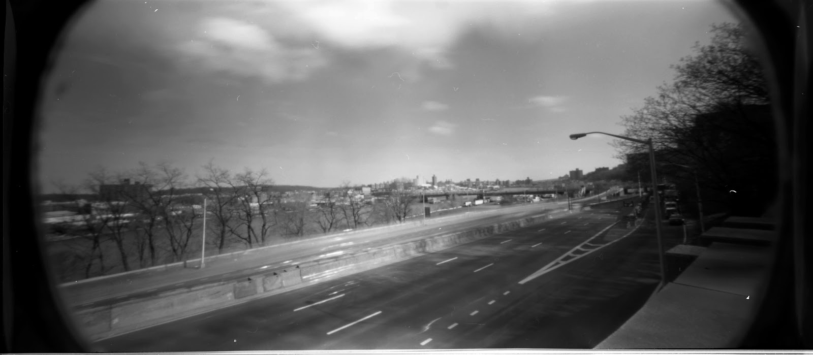
I was thinking about this picture as I was driving home, and looking past the modern buildings and transit artery’s, I could still glimpse the ancient terrain features. The quality of the print is such that I thought that maybe I could find the location or angle that it was drawn from. This has been done with many early photographs from the civil war with remarkable results.
Driving down the highway I try and see if I can match up the angle of view that is similar to the print. Then I look off to my left to see what terrain feature I could use to photograph from. I identified a wooded area under the University. It has a road I could park and offers a high vantage point where I could look out over the highway.


Last March the week before the leaves appeared I was able to make some photographs of the area. I wasn’t happy with the results, partly due to the area is not that photogenic as it exists today and I also had some camera, exposure issues. I also realized that I was not in the right place the original drawing was made.
I constructed a Google map to get a better visualization of the area. Check it out. I guess before the leaves pop out and obstruct the view again I will try and get a photograph from this new vantage point.


View Battle of Fort Washington Painting in a larger map

Fort Hamiliton and Fort Lafayette


 Here are so cool shots of Fort Lafayette and Fort Hamilton. These forts are/ were at the entrance of the upper New York harbor. Fort Lafayette, like many islands and forts in the NYC area, was a prison during the Civil War. Again I got these images from the Brooklyn Museum of Art web site. I hope to get some modern photographs to match up this in the  future.

From wikipedia - (http://en.wikipedia.org/wiki/Fort_Lafayette)

Fort Lafayette was an island coastal fortification in the Narrows of New York Harbor, built offshore from Fort Hamilton at the southern tip of what is now Bay Ridge in the New York City borough of Brooklyn. The fort was built upon a natural island known as Hendrick's Reef.
Construction on the fort began during the War of 1812 and was finally completed in 1818, the fort originally named Fort Diamond was renamed in 1825 to celebrate the Marquis de La Fayette, a hero of the American Revolution who was returning to his native France after his year-long grand tour of the United States.
Construction of the Verrazano-Narrows Bridge caused the fort's destruction in 1960; the Brooklyn-side bridge pillars now occupy the fort's former foundation site.

Below are some stereo photographs of Fort Hamilton.I also want to say the Harbor Defence Museum is worth checking out- http://www.harbordefensemuseum.com/