|
| My new DIY camera! The DC67 TRL "Twin Lens Reflex". Bought on E-bay as a plastic kit for $12.00 and free shipping! |
 |
| Cannon at Antietam with light leak. Shot with the DIY camera on Kentmere using 400ASA film. It's recommended that 200 speed film be used. The aperture is fixed. It's a simple piece of plastic with a hole in it. The following shots are my first roll used in the new camera. |
 |
| Shot looking down the Hagerstown Pike. Bad light leak across the center of the frame. |
 |
| Another shot of the fence along the Hagerstown pike. This time the light leak is not as noticeable. I like the vignetting around the corners. Perhaps this camera has some potential after all. |
 |
| Fence along the "Bloody Lane". Shot with the Holga wide angle pinhole camera. I got some light leaks along the side of the film again. I think it must happen when I change the film. The camera is not winding the film tightly enough on the reel, so light can leak around the paper edges of the 120 film. I am still searching for a better way to change rolls in the field. Working with 35 mm film I found a small two reel plastic tank for developing the film. I think that I can use this to put the shot 120 film rolls in. Doing everything in my changing bag. That way everything can be done in the dark and kept light tight. |
 |
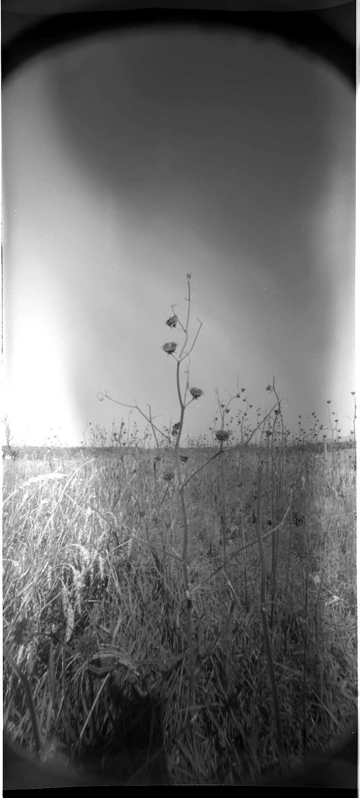
| empty field- Antietam |
|
 |
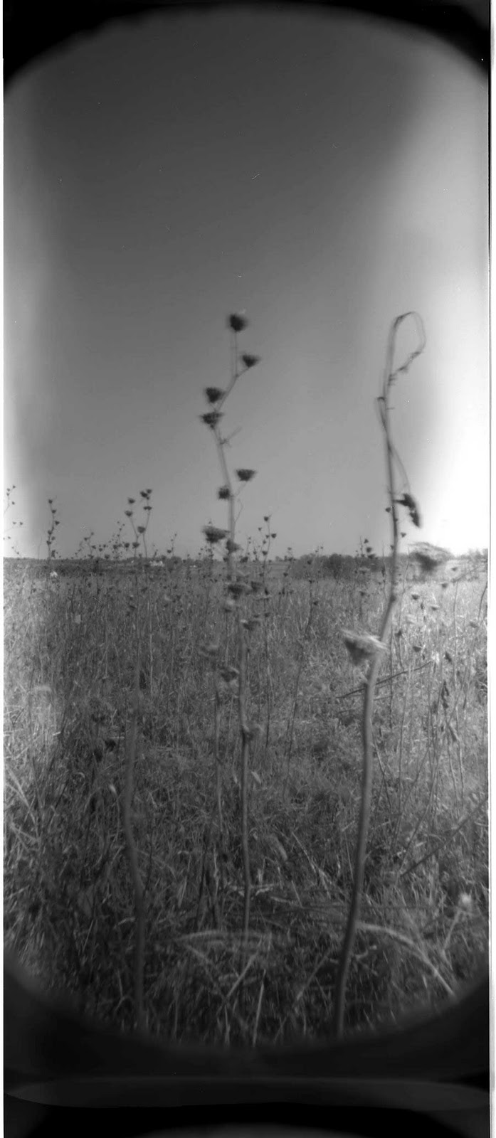
| weeds standing tall where once Union solders stood |
 |
| Fall weeds in the field in front of the "bloody Lane" |
 |
| Pin hole image looking down "Bloody Lane" |
Had a great driving adventure the week of October 8-9. It was a perfect fall weather weekend. Plus, I got a chance to check out some places in Maryland that I have never been to before. My sketchy plan was to drive down to Harper's Ferry and climb the bluffs of the Maryland Heights, over looking Harper's Ferry. Early Saturday morning I left Brooklyn and headed south, reaching Gettysburg around 10AM. I was hoping to stop off and get a bite to eat. However the diner I had in mind wasn't open yet. So I continued South.
Reaching the Harper's Ferry area, I drove around through town. I then remembered that you have to park outside of town and take a bus back in. The town is so small there is no way for everyone to park there. Heading back out, I stopped and got directions to the Maryland Heights trail, back over on the Maryland side of the Potomac River. I found the road that leads under the highway and then runs along the railroad and B&O canal. Following that road, I soon came to the pathway that leads up to the heights, but it was swarming with people. There is limited parking along the side of the road and sure enough all the spots were taken. With my hopes of completing my quest dashed, I continued along and took the first road, up and out of the mountains. Heading away from Harper's Ferry and into the unknown.
One of the great things about driving around this part of the country is that it's almost imposable to get lost for very long. All you need to do is remember your Civil War history. Using that knowledge when you get to a town or named road, you can think back and orient yourself. In this particular scenario, I thought of the Confederate army, under Stonewall Jackson, marching, or more like running, up the road to Sharpesburg, after accepting the surrender of the Federal forces at Harper's Ferry. The timely arrival of Jackson's men thus helped save Lee's forces engaged in the battle of Antietam. Little did I know at the time, but sure enough the road lead right up to Sharpsburg and the Antietam Battlefield. What beautiful country. No wonder it's called the "pleasant valley".
On this trip I was planning a larger photo-shoot of the Maryland Heights. Kick starting a large new project that I have in mind, so I brought along all my cameras. However I ended up only shooting with the Holga Wide angle pinhole and my newest 35mm DIY "chi-com" camera. After arriving at Antietam I wasn't feeling the photography vibe. Driving around all day makes me want to keep moving, so it's hard for me to stop, and switch gears. I have to make a real effort to stop the car, get out, and look around. It's even harder for me to see something and stop to turn around to check it out. We all tend to place all sorts of artificial boundaries on our self's. These become habits and are therefore hard to break. This one that I've got to work on! I hope the awareness part of this is the first step of fixing it. I also had no plans for shooting at Antietam. But I did get a chance to check out my new camera. Anyway, here are the results. The images are in no particular order. Enjoy.
 |
| The next day I took the family back to South Mountain. We found the monument to General Reno, the Union general that was killed in action here. |
 |
| The Reno Monument South Mountain |
 |
| The camera is small and light weight. |
 |
| The camera comes as a plastic kit. Just like a model car. The only problem is the instructions are in Chinese! |
 |
| Corn field at Antietam. Shot with the DIY camera on Kentmere 400ASA film. I don't know why the center is out of foucesorn field at Antietam. Shot with the DIY camera on Kentmere 400ASA film. I don't know why the center is out of fouces. I was playing with focusing but I didn't take any notes. Shooting 35mm film after using 120 and 4x5 is like playing around with toy film. Oh yeah....... it is a toy! |