|
| The intriguing photograph that started my thinking. Matthew. Brady's photograph taken on Governors Island 1860's. My question is whether the distant cityscape is a view of Manhattan or of Brooklyn? This image can be found on Flicker here. |
 |
| A stereo image on damaged glass plate from the same location. This image has a little more detail and shows a wider angle of view. Click on it to enlarge it. Taken from the Library of Congress Flicker page. |
This blog post is a continuation of posts that I started this summer about Governors Island and my "back yard", New York Harbor. In this post I will discuss the above photograph taken by Matthew Brady during the Civil War period 1861-65. I became intrigued when I first saw this image of Governors Island. I came across it at the book store run by the National Park Service on the island. I don't remember what book it was in. But I remember being captivated by it. It has a lonesome melancholy quality, the deserted shore line with leafless tress and the half sunken boat. Pointing it out to my friends saying "Don't you think that this is a shot of Brooklyn? Look you can see that church steeple down the street from where we live." My friend replied "No, that must be a view of Manhattan. And that is the church on Broadway and Wall Street (Trinity Church)." Well I didn't want to argue with him, but I didn't believe he was right. The problem was I could not prove my hunch. There is not enough definitive information in the photo to be sure of a proper id.
That was until I saw some more photographs from Brady's visit to the Island. So far I have found four images that he took on that day. I am assuming they were all done on the same day/ trip. All the photographs are taken on the Northern part of the island. And all are taken in the same general area, looking West and looking East along the north beach in the vicinity of and on top of Castle Williams. It also appears that the images are from the same time of year. I believe that Castle Williams was used as a prison for Confederate prisoners at the time and this may have been the reason that Brady photographed the area. This blog post is a description of what I found after examining these photos.
In trying to identify the angle of view, what stood out at me was I felt that the distant city skyline just didn't feel like a period Manhattan skyline. For one the rise of the land seemed too high. Manhattan is built on high ground centering along the spine of Broadway, but not as high up from the harbor as depicted. I also expected to see a greater variety of building heights; taller buildings rising in greater comparison with Trinity Church at Broadway and Wall. However the practicality of proving Manhattan or Brooklyn at the time seemed moot. That was until I saw the photograph below.
 |
| At last. The photo that proves my guess was right. The NPS has even correctly stated that this is a view to the East, and Brooklyn. This photograph was taken from the ramparts on top of Castle Williams. So far I have not found a higher quality scan of this image. |
The above photograph was found in an online
book about the history of Fort Jay. I used this book to research an earlier blog post about the fort. After downloading it I was looking through it for any interesting photographs. I lingered over this one. It took a minute or two to digest the image. The book cites the buildings on the left side of the image. These buildings were part of the Fort Jay complex, all well and good if your are writing a book about Fort Jay. But looking closer I noticed on the left side of the photograph. I noticed the half sunken barge. Oh say that's the same barge that's in the earlier image that I was thinking about. I believe this photograph proves that the view from the beach is in fact a view of Brooklyn. In fact the beach view is a part of this image. The central element of identifying the part of town that is depicted is the distinctive church steeples. Figuring out the mystery of what steeple it is would be the key to solve the location. So lets look at Brooklyn's church steeples.
 |
| In the above image I have diagrammed the elements of the beach photo. Because of the higher angle of being onto top of Castle Williams. We are able to make out more detail in the South Brooklyn sky line. Visible are other church steeples. Perhaps they can be identified today. |
Old Saint Paul's
At last. A opportunity to photograph the old churches in my neighborhood of Brooklyn. Brooklyn has been called the "city of churches". In fact in my area of South Brooklyn there is a old church on every other corner. They hark back to a time where churches represented not only a place to worship but community. Many churches were founded and catered to the different immigrant groups that came through Brooklyn. Church services were given in the native language of specific immigrant groups. Norwegian, Italian, German are some local examples.Today due to changing demographics, a number of the old churches have been converted into condos. Do the churches that are pictured in the Brady photograph exist today? To answer that question we must take a walk.
 |
| Here is a blow up from the stereo image above. Note how there is a tall square tower part before the spire starts. |
 |
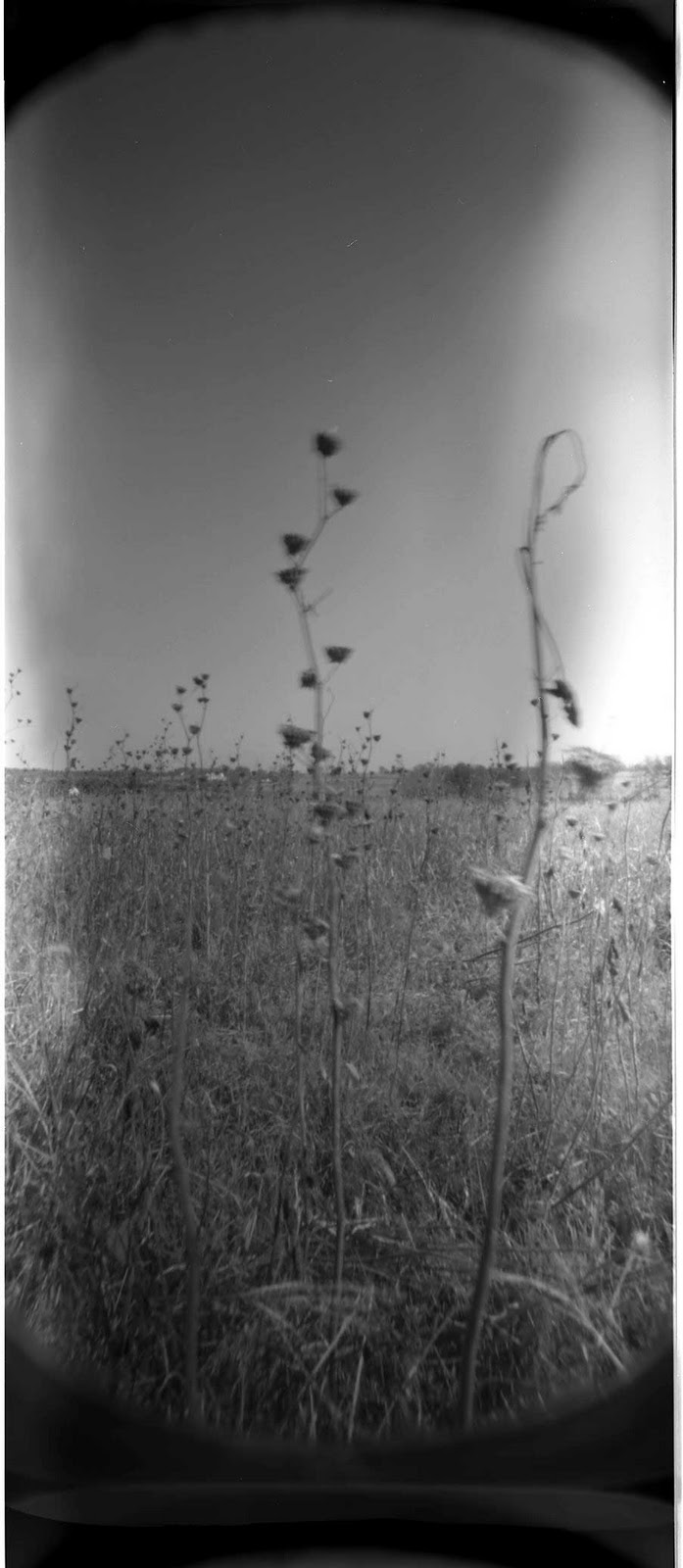
| My modern view taken with my DIY 35mm camera. From this angle you can see the tall square tower similair to the Brady |
. Could it be the steeple from Old St Paul's? To answer that question we must first find out if the steeple was there in the 1860's. Time to troll the Internet.
"From the AIA Guide, it would seem that much of St. Paul's church at Court and Congress Streets was designed and built about 1838 by Gamaliel King, allowing the claim that this church is the oldest Catholic church in continuous use in Brooklyn. The steeple was added in the 1860's, and other enlargements were made. The church fronts on Court Street, the chapel and former rectory on Congress Street. For a while, the parish had three names: St. Peter (from the church on Hicks Street that is now a condo), Our Lady of Pillar, and St. Paul. The signs now name it as the parish of St. Peter and St. Agnes, with services alternating between the two church buildings."
The important part of this history is the dates. One the church dates from the late 1830's and that the steeple was added in the 1860's.Both of these time frames are workable. However the steeple must date from the first half of the 1860's to be relevant.
 |
| The only early image from a postcard I could find of Old St Paul's. Taken from the corner of Bergen and Court Street. To bad that the whole steeple is not shone. |
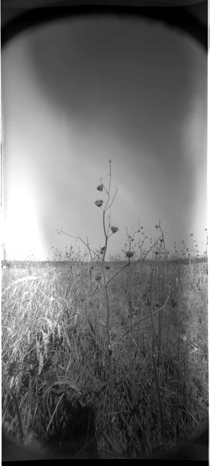
For photographing this time around I loaded up my DIY 35 mm camera and headed to Court Street. I wanted to test this camera out again because of the light leak issue. I found a screw that I did not fully tighten. I also put some tape over the hole for good measure. All and all I'm quite impressed with the results this time. I find that if I screw the lens all the way out I get a wonderful vignette! Below, a number of pictures, enjoy.
 |
| Looking up at the church steeple. The steeple was renovated with in the last couple of years. |
 |
| View from Congress Street. |
 |
| View from further down Congress Street showing more of the collection of buildings that are part of this church. |
 |
| Plaque near the front entrance. |
South Congregational Church
Using the third Brady image taken from on top of Castle Williams, a second Church steeple can be seen. This steeple seems to have another tower part to it. I believe that this matches up nicely with our second church, the Congregational Church located on President and Court Street..
 |
| A blow up of the image taken on top of Castle Williams. Sorry for the poor resolution. It looks to me that this steeple matches up nicely with the South Congressional Church on Court and President Street. Note the two towers. The right one is a tall thin steeple. The left is a box. Also note the height different between the two. |
| The South Congregational Church in a unknown period photo showing the tall steeple and the smaller square tower. This view is taken from the front while the Brady photograph is taken from behind. Thus explaining the reversed towers. |
"The South Congregational Church was established in 1851 in a sparsely settled Scandinavian enclave of South Brooklyn. A chapel was built in 1851, and the brick Early Romanesque Revival church was completed in 1857. As the area developed and became known as Carroll Gardens, the church added a ladies' parlor in 1889, followed by the neo-Gothic rectory in 1893. By the 1940s, the church was thriving and numbered 2400 members, but in the years following World War II, members moved away and dropped to fewer than 100. The congregation now meets in the former parlor, and the church and chapel have been converted into condominiums. The South Congregational Church Complex was designated by the New York City Landmarks Preservation Commission in 1982."
| Taken from http://www.nycago.org/Organs/Bkln/html/SouthCong.html |
|
And now my modern view of the South Cong. church/condo. Note the obvious lack of a steeple.I remember talking with a older gentleman a number of years ago. He was saying that he remembered the hurricane of '38 toppling off the church steeples. Another steeple anecdote from the neighborhood that I came across is a exciting newspaper account of a church steeple being hit by lighting. More can be read about it here.
http://www3.gendisasters.com/new-york/12448/brooklyn-ny-st-agnes-church-destroyed-lightning-amp-fire-jul-1901
Perhaps the South Congregation Church was a victim of such a calamity. On the other hand keeping such a structure maintained through the years is quite costly.
 |
| The view from Court Street of the two steeples. |
 |
| A closer view of the tower as it is today with out its long spire. |
 |
| The rear corner of the chapel along President Street. |
 |
| A poor photograph of a rear entrance to the chapel. The soft sand stone is |
The Last Brady Image of Castle Williams.
 |
| This is the image that Matthew Brady took looking at Castle Williams. I believe he must have taken this image from the same area the he took the other two images of Brooklyn. Image from NPS. He changed his angle from East to West. |
Above is probably the photograph that Matthew Brady came to the island to take. The semicircular walls of Castle Williams. I believe at the time it was used as a prison for Confederates. Another Fort in New York Harbor was also used in such a way. It's name was Fort Lafayette.
View M. Brady at Governors Island, in a larger map
 |
I found this example on line that shows a "Erie Canal boat" This type of boat was no stranger to New York Harbor waters.It matches our half sunken vessel in the Brady photograph pretty well. This is a water line model of a typical Erie Canal Boat Circa 1890's. The model was produced in Z scale from historical photographs. Taken from Monroe Models 1101 25th Ave. N St. Cloud, MN. 56303
|